SN9107 : Dinas Ropeway Foundation
taken 12 years ago, near to Pontneddfechan, Powys, Wales
The quartz (or silica) mine at Dinas Rock (Craig-y-Ddinas) near Pontneddfechan featured tramways and an aerial ropeway. The ropeway ran from the mine here SN9107 : Abandoned mine workings by the river Sychryd up onto the rock to the west across the river and then down to somewhere near here SN9107 : Changing Area at Craig-y-Ddinas Carpark.
Both the following documents quote a 1963 survey of the site where the manager claimed that this ropeway had the longest span in the country Linkand Link
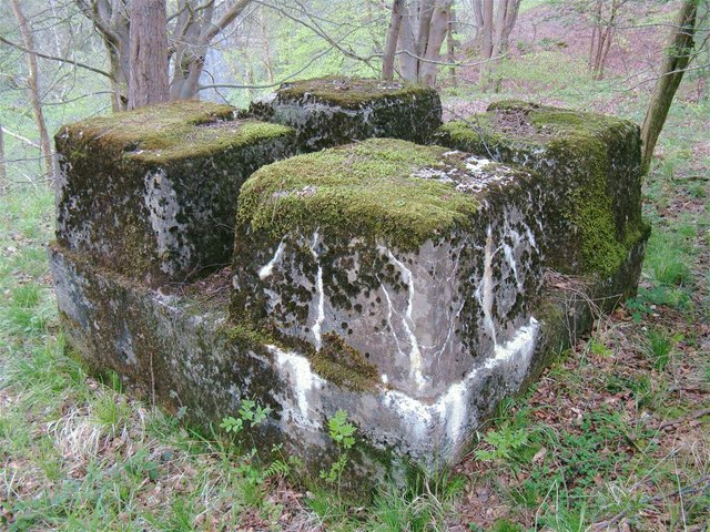
All that remains now are the concrete foundations of the towers or "standards" plus the occasional length of rusting steel rope. Each of the four portions of concrete has a stump of the metal tower embedded in it.
The mine operated from the 1820s up to 1964. Ironically the ropeway first featured on the 1964 OS map at old-maps, not being present on the 1918 one.
 Map © Crown Copyright")
- Grid Square
- SN9107, 50 images (more nearby 🔍)
- Photographer
- Nigel Davies (more nearby)
- Date Taken
- Sunday, 6 May, 2012 (more nearby)
- Submitted
- Thursday, 10 May, 2012
- Subject Location
-
OSGB36:
 SN 9152 0796 [10m precision]
WGS84: 51:45.5870N 3:34.3908W - Camera Location
-
OSGB36: SN 9152 0796
- View Direction
- North-northeast (about 22 degrees)