TQ3877 : Royal Naval College - east gate and lodges
taken 12 years ago, near to Greenwich, England
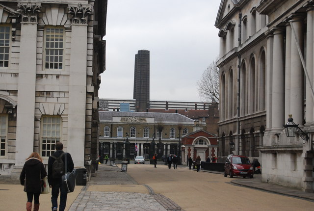
Built for charitable public purpose the Old Royal Naval College was established by Royal Charter in 1694 for the relief and support of seamen and their dependants.
Sir Christopher Wren planned the site and during the first half of the eighteenth century various illustrious architects, such as Hawksmoor, Vanbrugh and James Athenian Stuart completed the design.
As the nineteenth century wore on, with peace established, numbers of Pensioners declined and the Hospital finally closed in 1869. Soon after this the Royal Naval College moved in heralding a new beginning for the site as a naval training centre for officers from around the world. In 1998 the Royal Navy departed for its new base at Shrivenham and responsibility for the College passed to the newly established Greenwich Foundation. Link
The University of Greenwich is a university located in the Royal Borough of Greenwich, London. The main campus is located on the grounds of the Old Royal Naval College in Greenwich. There are other smaller campuses scattered around Kent and SE London, including the Universities at Medway site.
Wikipedia: Link
Website: Link
Grade I listed buildings and structures are of exceptional, even international importance. There are over 6,000 in the country. Only 2.5% of listed buildings are Grade I listed.
In Scotland the classification is Category A
Index: Link
The Maritime Greenwich World Heritage Site comprises the historic town centre, Royal Park and related institutional buildings, and was inscribed by the World Heritage Convention in 1997.
Maritime Greenwich has joined a unique club of the most important and natural places on earth.
The ensemble of buildings at Greenwich and their landscape setting, including the Royal Park, are a potent architectural symbol of English artistic, scientific and other institutional endeavour, notably from the 17th to late 19th centuries.
Website & map: Link
 Map © Crown Copyright")
- Grid Square
- TQ3877, 2289 images (more nearby 🔍)
- Photographer
- N Chadwick (more nearby)
- Date Taken
- Friday, 17 February, 2012 (more nearby)
- Submitted
- Friday, 11 May, 2012
- Subject Location
-
OSGB36:
 TQ 3867 7797 [10m precision]
WGS84: 51:29.0214N 0:0.2588W - Camera Location
-
OSGB36: TQ 3861 7793
- View Direction
- East-northeast (about 67 degrees)