2012
SU3986 : Old benchmark on building at Manor Farm
taken 12 years ago, near to Wantage, Oxfordshire, England
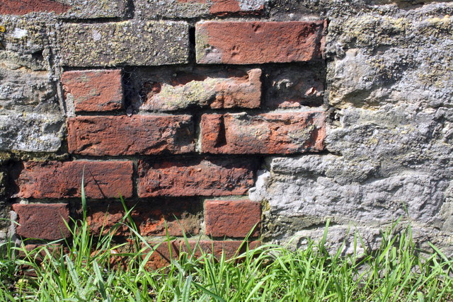
Old benchmark on building at Manor Farm
Ordnance Survey cut mark benchmark described on the Bench Mark Database at Link
 Map © Crown Copyright")
TIP: Click the map for more Large scale mapping
- Grid Square
- SU3986, 13 images (more nearby 🔍)
- Photographer
- Roger Templeman (more nearby)
- Date Taken
- Saturday, 12 May, 2012 (more nearby)
- Submitted
- Sunday, 13 May, 2012
- Subject Location
-
OSGB36:
 SU 3972 8640 [10m precision]
WGS84: 51:34.5044N 1:25.6943W - Camera Location
-
OSGB36: SU 3973 8640
- View Direction
- West-southwest (about 247 degrees)