2012
SJ6196 : Re-colonised sand-pit, Town of Lowton
taken 12 years ago, near to Golborne, Wigan, England
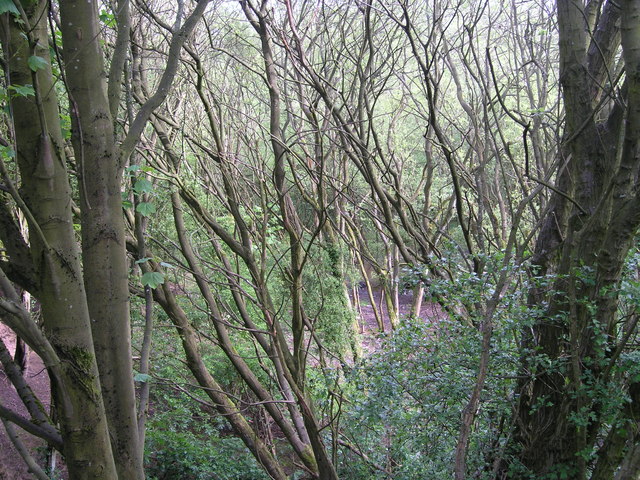
Re-colonised sand-pit, Town of Lowton
This sand pit (approx 17m deep) was the last of a series which exploited the glacial deposits on either side of the A572 between Newton-le-Willows and Lowton during the 19th/20th centuries (nearby are Sandfield Hall and Sandup Farm!). It has now almost completely recolonised with trees, though only 20 years ago there was considerable open grassland.
 Map © Crown Copyright")
TIP: Click the map for more Large scale mapping
- Grid Square
- SJ6196, 14 images (more nearby 🔍)
- Photographer
- John Boothby (more nearby)
- Date Taken
- Sunday, 13 May, 2012 (more nearby)
- Submitted
- Tuesday, 15 May, 2012
- Subject Location
-
OSGB36:
 SJ 6104 9610 [10m precision]
WGS84: 53:27.6119N 2:35.2949W - Camera Location
-
OSGB36: SJ 6110 9607
- View Direction
- West-northwest (about 292 degrees)