2012
NZ2171 : Path through Havannah/Three Hills Nature Reserve
taken 12 years ago, near to Dinnington, Newcastle Upon Tyne, England
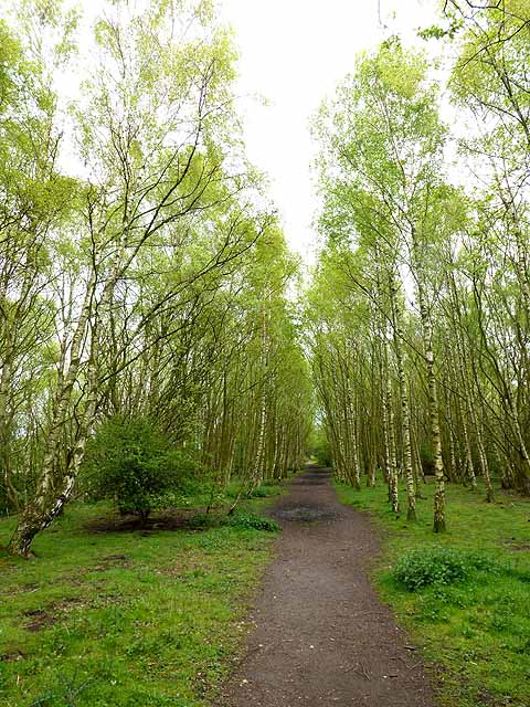
Path through Havannah/Three Hills Nature Reserve
Havannah/Three Hills Nature Reserve stands on the remains of the Havannah Drift Mine which operated from 1950 to 1977. The land was subsequently reclaimed and made into a public open space in 1994, and later into a Local Nature Reserve. The landscape is dominated by birch and scrub.
 Map © Crown Copyright")
TIP: Click the map for more Large scale mapping
- Grid Square
- NZ2171, 15 images (more nearby 🔍)
- Photographer
- Oliver Dixon (more nearby)
- Date Taken
- Wednesday, 16 May, 2012 (more nearby)
- Submitted
- Wednesday, 16 May, 2012
- Subject Location
-
OSGB36:
 NZ 2157 7176 [10m precision]
WGS84: 55:2.3933N 1:39.8407W - Camera Location
-
OSGB36: NZ 21553 71762
- View Direction
- EAST (about 90 degrees)