2012
SK2168 : All Saints' church, Bakewell
taken 12 years ago, near to Bakewell, Derbyshire, England
This is 1 of 2 images, with title All Saints' church, Bakewell in this square
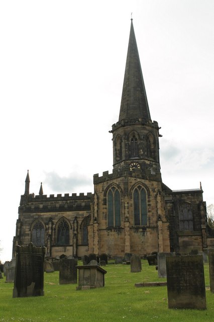
All Saints' church, Bakewell
Grade I listed.
Originally of collegiate status, the church was built in the 12th C. The church was remodelled in the 13th century and was one of the finest examples in Derbyshire of Early English architecture. A lot of work was carried out in the 13th century, the south porch was added in the 14th century. The tower had a spire of 186 feet. It was probably built in the late 14th C.
However the weight of the Spire was too much, and buttresses were added, but the weight of the spire was still a problem over the years, and the spire was taken down in 1825
The church was restored in 1839 and a vast quantity of Saxon and early English stones were found. These were incorporated into the new building. The rest are now visible in the porch and an archway in the church. A new spire was built in 1843 which was 16 feet shorter than the old one.
The church contains some interesting monuments from the 14th C. onwards. There is a late 13th C. sedilia and double piscina. Octagonal font is 14th C.
See other images of All Saints' church, Bakewell
 Map © Crown Copyright")
TIP: Click the map for more Large scale mapping
- Grid Square
- SK2168, 1113 images (more nearby 🔍)
- Photographer
- J.Hannan-Briggs (more nearby)
- Contributed by
- Julian P Guffogg (more nearby)
- Date Taken
- Sunday, 13 May, 2012 (more nearby)
- Submitted
- Wednesday, 16 May, 2012
- Subject Location
-
OSGB36:
 SK 2157 6848 [10m precision]
WGS84: 53:12.7768N 1:40.7078W - Camera Location
-
OSGB36: SK 2161 6847
- View Direction
- WEST (about 270 degrees)