2012
NM3399 : Trig point and cairn at the summit of Orval
taken 12 years ago, 3 km from Harris, Rum, Scotland
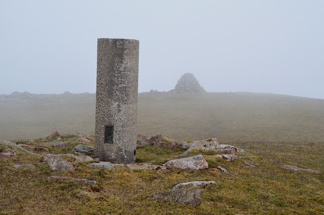
Trig point and cairn at the summit of Orval
And not much else... As the highest point (571m) in the NW of Rum this must afford a superb view past Bloodstone Hill to Canna, a panorama to Skye and both the Rum and Skye Cuillin. However, the weather gods saw me coming and arranged a sufficiently moist SW airstream to nudge the cloud base down to about 500m.
 Map © Crown Copyright")
TIP: Click the map for more Large scale mapping
- Grid Square
- NM3399, 16 images (more nearby 🔍)
- Photographer
- Jim Barton (more nearby)
- Date Taken
- Saturday, 12 May, 2012 (more nearby)
- Submitted
- Saturday, 19 May, 2012
- Subject Location
-
OSGB36:
 NM 3331 9909 [10m precision]
WGS84: 57:0.3403N 6:23.6419W - Camera Location
-
OSGB36: NM 3337 9912
- View Direction
- West-southwest (about 247 degrees)