2012
NM8229 : Kerrera from the Oban-Mull ferry
taken 12 years ago, near to Balliemore, Kerrera, Argyll And Bute, Scotland
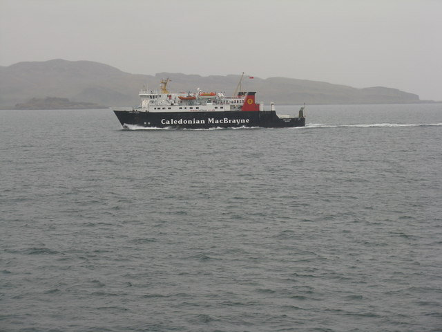
Kerrera from the Oban-Mull ferry
An indistinct view through the rain, with the cliffs of Rubha na Lice to the right. The ferry heading to Oban is Caledonian Macbrayne's 'Lord of the Isles'.
 Map © Crown Copyright")
TIP: Click the map for more Large scale mapping
- Grid Square
- NM8229, 18 images (more nearby 🔍)
- Photographer
- M J Richardson (more nearby)
- Date Taken
- Monday, 7 May, 2012 (more nearby)
- Submitted
- Sunday, 20 May, 2012
- Subject Location
-
OSGB36:
 NM 8249 2950 [10m precision]
WGS84: 56:24.4497N 5:31.6242W - View Direction
- SOUTH (about 180 degrees)