2006
SU1089 : Crosslanes, Purton
taken 17 years ago, near to Purton Stoke, Wiltshire, England
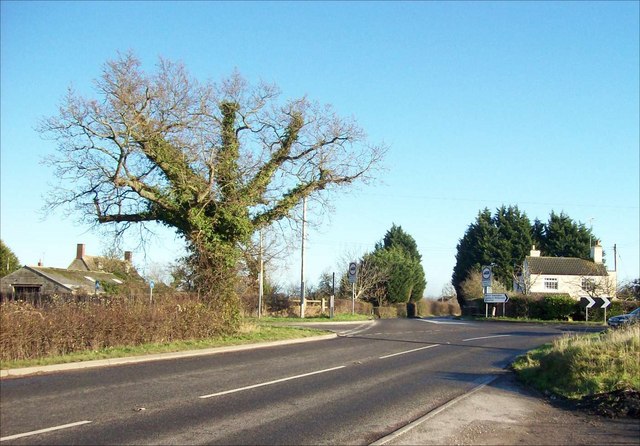
Crosslanes, Purton
This country crossroads at the West of Purton parish includes Packhorse Lane - the road in the foreground. This minor road was once the Bristol to Oxford coach road. In 1738, George II's geographer Cowley showed it as one of only two major roads crossing North Wiltshire - the other was today's A4. The white cottage on the right was the keeper's cottage for Crosslanes Lock on the North Wilts Canal. The now-vanished canal (it closed in 1912) is the subject of an active restoration scheme. On the left is Crosslanes Farm.
 Map © Crown Copyright")
TIP: Click the map for more Large scale mapping
- Grid Square
- SU1089, 110 images (more nearby 🔍)
- Photographer
- Chris Randall (more nearby)
- Date Taken
- Sunday, 17 December, 2006 (more nearby)
- Submitted
- Tuesday, 19 December, 2006
- Subject Location
-
OSGB36:
 SU 106 897 [100m precision]
WGS84: 51:36.3623N 1:50.9001W - View Direction
- East-northeast (about 67 degrees)