2012
SU5850 : Sunday - a day of rest
taken 12 years ago, near to East Oakley, Hampshire, England
Sunday - a day of rest
No work on the demolition today.
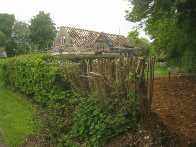
St John's Church
A collection of photos to record the last days of St John's Church. The church had not been in use for quite a few years. The earliest image on the 'Geograph' site was taken by the late Michael Ford in 2001. SU5850 : St John, East Oakley. Demolition work started on Wed 16 May 2012. Once the site was cleared a new war memorial garden with four seats was laid out. The War memorial, after some maintenance was slightly moved to where the communion table once stood. Burials continue to take place here.
The church was given by Mr Sidney Bates of Manydown Park, it was opened in January 1914. The building was only intended to last for 15 years. At the time this area was part of the parish of Wootton St Lawrence known as St John's.
 Map © Crown Copyright")
TIP: Click the map for more Large scale mapping
- Grid Square
- SU5850, 3140 images (more nearby 🔍)
- Photographer
- Mr Ignavy (more nearby)
- Date Taken
- Sunday, 20 May, 2012 (more nearby)
- Submitted
- Wednesday, 23 May, 2012
- Subject Location
-
OSGB36:
 SU 5812 5007 [10m precision]
WGS84: 51:14.8110N 1:10.1218W - Camera Location
-
OSGB36: SU 5813 5010
- View Direction
- South-southwest (about 202 degrees)