2012
NN1639 : South side of Beinn nan Aighenan
taken 12 years ago, near to Coire Slatach [other Features], Argyll And Bute, Great Britain
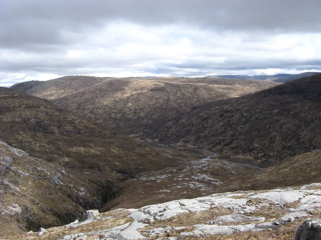
South side of Beinn nan Aighenan
There is quite a lot of slabby rock of the south side of Beinn nan Aighenan and many of the streams are in rocky gorges as can be seen in this photo. The river Kinglass can be seen at the bottom of the hill.
 Map © Crown Copyright")
TIP: Click the map for more Large scale mapping
- Grid Square
- NN1639 (more nearby 🔍)
- Photographer
- Andrew Spenceley (more nearby)
- Date Taken
- Monday, 30 April, 2012 (more nearby)
- Submitted
- Wednesday, 23 May, 2012
- Subject Location
-
OSGB36:
 NN 167 393 [100m precision]
WGS84: 56:30.6349N 4:58.7875W - Camera Location
-
OSGB36: NN 161 394
- View Direction
- EAST (about 90 degrees)