2012
NY6857 : Field above Tows Bank
taken 12 years ago, near to Stonehouse, Northumberland, England
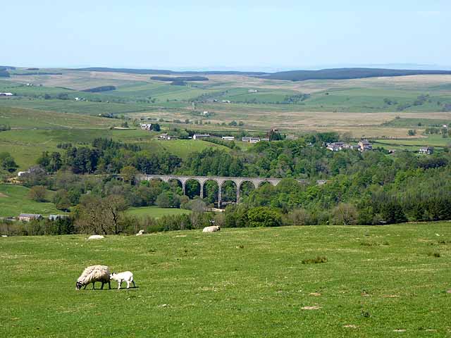
Field above Tows Bank
Looking north-westwards down South Tynedale to the Lambley viaduct NY6758 and Lambley village. Wark Forest and the hills along the Scottish border can be seen in the distance.
 Map © Crown Copyright")
TIP: Click the map for more Large scale mapping
- Grid Square
- NY6857, 8 images (more nearby 🔍)
- Photographer
- Oliver Dixon (more nearby)
- Date Taken
- Saturday, 26 May, 2012 (more nearby)
- Submitted
- Monday, 28 May, 2012
- Subject Location
-
OSGB36:
 NY 6858 5777 [10m precision]
WGS84: 54:54.8184N 2:29.4986W - Camera Location
-
OSGB36: NY 68720 57695
- View Direction
- West-northwest (about 292 degrees)