2012
SJ8223 : Bridleway & footpath junction at Knightley Green
taken 12 years ago, near to Lawnhead, Staffordshire, England
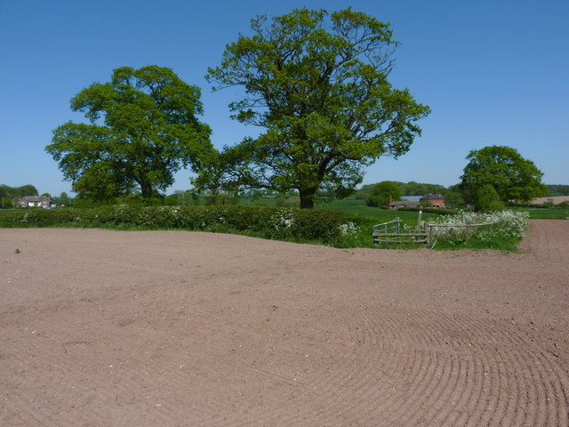
Bridleway & footpath junction at Knightley Green
The gateway 20 yards ahead marks the junction - the bridleway heads left to Lower Knightley, whilst the footpath goes more or less straight on to the buildings visible through the trees at Knightley Green.
 Map © Crown Copyright")
TIP: Click the map for more Large scale mapping
- Grid Square
- SJ8223, 9 images (more nearby 🔍)
- Photographer
- Richard Law (more nearby)
- Date Taken
- Friday, 25 May, 2012 (more nearby)
- Submitted
- Monday, 28 May, 2012
- Subject Location
-
OSGB36:
 SJ 8209 2361 [10m precision]
WGS84: 52:48.5842N 2:16.0285W - Camera Location
-
OSGB36: SJ 82050 23599
- View Direction
- East-northeast (about 67 degrees)