2006
SX5381 : Lower Willsworthy and Will farms
taken 17 years ago, near to Lane End, Devon, England
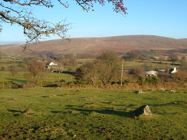
Lower Willsworthy and Will farms
From the lane between Horndon and Will, which is the farm on the right. To the left of Lower Willsworthy, the prominent white house on the left, is Higher Willsworthy (a vanished manor lay between the two). Standon Down is behind.
 Map © Crown Copyright")
TIP: Click the map for more Large scale mapping
- Grid Square
- SX5381, 40 images (more nearby 🔍)
- Photographer
- Derek Harper (more nearby)
- Date Taken
- Thursday, 21 December, 2006 (more nearby)
- Submitted
- Friday, 22 December, 2006
- Subject Location
-
OSGB36:
 SX 531 815 [100m precision]
WGS84: 50:36.8798N 4:4.6642W - Camera Location
-
OSGB36: SX 5310 8149
- View Direction
- East-northeast (about 67 degrees)