2012
TQ3080 : St Mary's Marker
taken 12 years ago, near to London, The City of London, England
This is 1 of 83 images, with title starting with St in this square
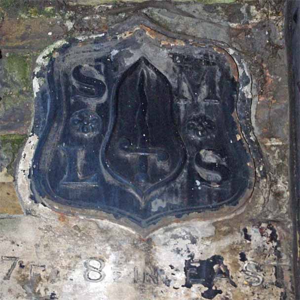
St Mary's Marker
This is the parish marker of St Mary-le-Strand in TQ3080 : Strand Lane WC2 it is attached to the wall of "The Playground". This was part of King's College School that moved to Wimbledon in 1908. However tradition dies hard, the new King's College bicycle sheds are still referred to as being "in the playground" by KCL staff.
 Map © Crown Copyright")
TIP: Click the map for more Large scale mapping
- Grid Square
- TQ3080, 6977 images (more nearby 🔍)
- Photographer
- Glyn Baker (more nearby)
- Date Taken
- Sunday, 20 May, 2012 (more nearby)
- Submitted
- Sunday, 3 June, 2012
- Subject Location
-
OSGB36:
 TQ 308 808 [100m precision]
WGS84: 51:30.7023N 0:6.9559W - Camera Location
-
OSGB36: TQ 308 808
- View Direction
- West-southwest (about 247 degrees)