2006
NZ0345 : Carpark on the Waskerley Way
taken 17 years ago, near to Waskerley, County Durham, England
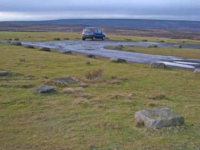
Carpark on the Waskerley Way
Across the picture runs the line of a disused railway - the Stanhope and Tyne Railway built to serve the needs of the Weardale lead and iron ore mining industries in the 19th century; the section in the photo is part of the nearly level summit section at 400 metres, the highest section of standard gauge railway in Britain Link (Archive Link ) . The line is now the Waskerley Way, a component part of the C2C cycle route which crosses northern England from coast to coast Link (Archive Link ) Link .
 Map © Crown Copyright")
TIP: Click the map for more Large scale mapping
- Grid Square
- NZ0345, 32 images (more nearby 🔍)
- Photographer
- Oliver Dixon (more nearby)
- Date Taken
- Friday, 22 December, 2006 (more nearby)
- Submitted
- Saturday, 23 December, 2006
- Subject Location
-
OSGB36:
 NZ 031 453 [100m precision]
WGS84: 54:48.1540N 1:57.1980W - Camera Location
-
OSGB36: NZ 031 452
- View Direction
- North-northwest (about 337 degrees)