SP9313 : The Entrance, College Lake Visitors Centre, nr Tring (April 2010)
taken 14 years ago, near to Marsworth, Buckinghamshire, England
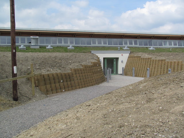
Work started on the current Visitors' Centre in 2009, which was designed to contain many eco-friendly features. It was opened the following year, and includes a reception area, small cafe (drinks, sandwiches, cakes, and ice creams) with views over the reserve, a display area, toilets and staff offices. There is a large hide with excellent views over the reserve immediately adjacent to it.
There are good disabled facilities and mobility vehicles can be arranged for those who cannot walk round the reserve.
College Lake is a large nature reserve with a very wide variety of habitats created from a large chalk pit. There is a large area of marsh with islands, and a deep water lake, while the cliffs surrounding the pit are in various stages of being "recovered" by nature. There is open meadow land and an area kept as an old fashioned cornfield full of flowers. There is woodland all round the area (originally planted to hide the quarry) and a large new woodland of native trees and shrubs. This all means that whatever time of the year you visit you can expect to see a wide variety of wildlife.
There are good facilities for the visitor (and for school parties), including many hides, and displays of old agricultural equipment. It is run by the Berks, Bucks & Oxon Wildlife Trust. Link
 Map © Crown Copyright")
- Grid Square
- SP9313, 178 images (more nearby 🔍)
- Photographer
- Chris Reynolds (more nearby)
- Date Taken
- Thursday, 15 April, 2010 (more nearby)
- Submitted
- Thursday, 7 June, 2012
- Subject Location
-
OSGB36:
 SP 9352 1393 [10m precision]
WGS84: 51:48.9711N 0:38.6821W - Camera Location
-
OSGB36: SP 9353 1391
- View Direction
- North-northwest (about 337 degrees)