2012
SD4679 : Across the Kent estuary
taken 12 years ago, near to Arnside, Cumbria, England
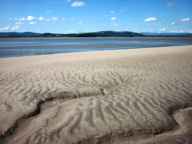
Across the Kent estuary
Looking over the exposed sandbank near Arnside station towards Whitbarrow and the distant Lakeland fells. The hot June sun has dried a ripple pattern created by the last high tide to drain off the bank.
 Map © Crown Copyright")
TIP: Click the map for more Large scale mapping
- Grid Square
- SD4679, 28 images (more nearby 🔍)
- Photographer
- Karl and Ali (more nearby)
- Date Taken
- Tuesday, 19 June, 2012 (more nearby)
- Submitted
- Friday, 22 June, 2012
- Subject Location
-
OSGB36:
 SD 4612 7955 [10m precision]
WGS84: 54:12.5306N 2:49.6558W - Camera Location
-
OSGB36: SD 4618 7905
- View Direction
- NORTH (about 0 degrees)