2012
NR8588 : Crinan Canal near Lochgilphead
taken 12 years ago, near to Lochgilphead, Argyll And Bute, Scotland
This is 1 of 2 images, with title Crinan Canal near Lochgilphead in this square
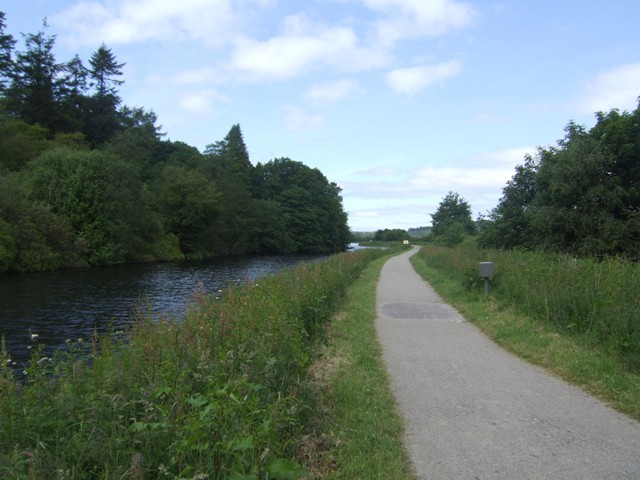
Crinan Canal near Lochgilphead
The Crinan Canal provides a shortcut for vessels between the Clyde and the West of Scotland that avoids the long, and often dangerous, route around the Mull of Kintyre. The canal runs between Ardrishaig on Loch Gilp, an arm of Loch Fyne, and Crinan giving access to the waters of the west coast.
The original proposals for such a canal date from the late 18th Century, and John Rennie was the civil engineer appointed to the project. Work was started in 1794 but was fraught with difficulties due to the terrain. After destructive floods and repairs, the canal opened in 1809 and was substantially repaired by Thomas Telford by 1817.
The canal has 15 locks (16, if you include the bar at the Crinan Hotel) and reaches its summit at Cairnbaan. The canal is supplied with water by a network of dammed lochs in the Knapdale forest. The harbours at Ardrishaig and Crinan are managed by British Waterways, who assumed responsibility for the canal in 1962. The sea lock at Crinan remains permanently open outside manned hours as a refuge for mariners.
The canal is now mainly used by leisure craft, although smaller naval vessels have been seen to pass through, as well as the preserved puffer VIC 32, which is based at Crinan. The length of the canal is enjoyed by walkers and cyclists, and provides an excellent vantage point to view the National Nature Reserve at Moine Mhor.
The harbours at either end retain commercial uses, with fishing vessels at Crinan and timber boats carrying away Argylls sitka spruce logs from Ardrishaig.
See other images of Crinan Canal
 Map © Crown Copyright")
TIP: Click the map for more Large scale mapping
- Grid Square
- NR8588, 27 images (more nearby 🔍)
- Photographer
- John M (more nearby)
- Date Taken
- Monday, 25 June, 2012 (more nearby)
- Submitted
- Monday, 25 June, 2012
- Subject Location
-
OSGB36:
 NR 857 887 [100m precision]
WGS84: 56:2.5901N 5:26.5103W - Camera Location
-
OSGB36: NR 857 886
- View Direction
- North-northwest (about 337 degrees)