2012
SK5739 : Nottingham, NG1 (Maid Marian Way)
taken 12 years ago, near to Nottingham, England
This is 1 of 123 images, with title starting with Nottingham in this square
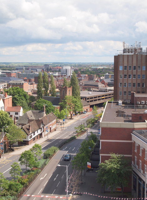
Nottingham, NG1 (Maid Marian Way)
A number of local landmarks are visible in this shot that leads the eye down Maid Marian Way (A6008) that is heading towards the Broadmarsh (previously Broad Marsh) section of the city, i.e. the area where upon the original Anglo-Saxon part of Snotengaham was established. (Snotengaham, i.e. HAM meaning 'home of' and SNOT referring to the leader of that early community).
 Map © Crown Copyright")
TIP: Click the map for more Large scale mapping
- Grid Square
- SK5739, 3590 images (more nearby 🔍)
- Photographer
- David Hallam-Jones (more nearby)
- Date Taken
- Saturday, 23 June, 2012 (more nearby)
- Submitted
- Thursday, 28 June, 2012
- Subject Location
-
OSGB36:
 SK 5703 3969 [10m precision]
WGS84: 52:57.0940N 1:9.1571W - Camera Location
-
OSGB36: SK 5698 3975
- View Direction
- Southeast (about 135 degrees)