2012

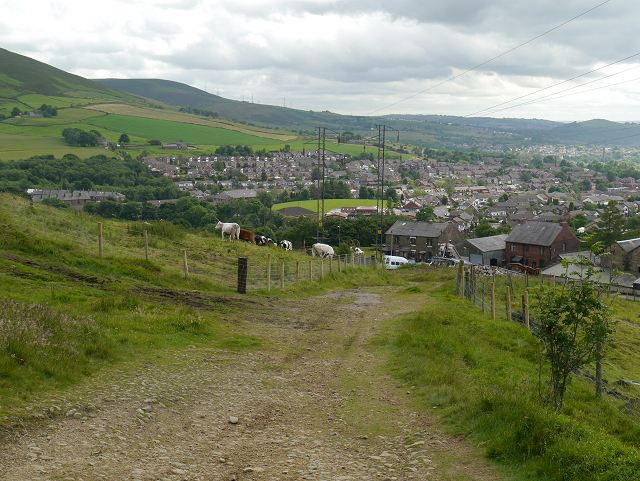
SD9801 : Pennine Bridleway

taken 12 years ago, near to Buckton Vale, Tameside, England

This is 1 of 2 images, with title Pennine Bridleway in this square
Pennine Bridleway
Pennine Bridleway
Heading towards Carrbrook.

Creative Commons Licence [Some Rights Reserved]   © Copyright David Dixon and licensed for reuse under this Creative Commons Licence.
Geographical Context: Uplands Paths other tags: Track Roman Road Path Bridlepath Bridleway Pennine Bridleway Moorland Moor Hill Farmhouse Farm Farm Building Farmland Grazing Cattle Cows Click a tag, to view other nearby images.
This photo is linked from: Automatic Clusters: · Pennine Bridleway at Carrbrook [7] Title Clusters: · Pennine Bridleway [2] ·
1:50,000 Modern Day Landranger(TM) Map © Crown Copyright
+
+
1:50,000 Modern Day Landranger(TM) Map © Crown Copyright
TIP: Click the map for more Large scale mapping
Grid Square
SD9801, 61 images   (more nearby 🔍)
Photographer
David Dixon   (more nearby)
Date Taken
Wednesday, 27 June, 2012   (more nearby)
Submitted
Friday, 29 June, 2012
Subject Location
OSGB36: geotagged! SD 9869 0154 [10m precision]
WGS84: 53:30.6325N 2:1.2734W
Camera Location
OSGB36: geotagged! SD 9870 0159
View Direction
South-southwest (about 202 degrees)
Clickable map
+
NW N NE
W Go E
SW S SE
Image classification(about): Geograph
This page has been viewed about 33 times
You are not logged in login | register