2012
SD9923 : Footpath from Swine Market Lane to Rudd Lane at the bottom end of the field access track
taken 12 years ago, near to Cragg Vale, Calderdale, England
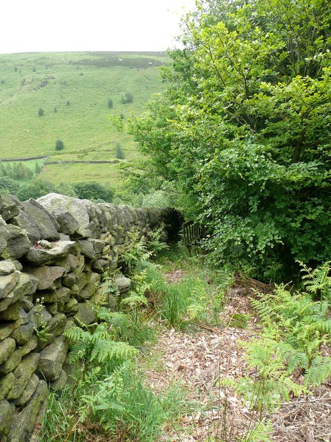
Footpath from Swine Market Lane to Rudd Lane at the bottom end of the field access track
Here there is a little gate at the top of a steep enclosed path covered in thick mud. Watch out for the tops of some millstone grit boulders against the wall on the left, which provide the only sure footholds. This is a branch of Hebden Royd FP82.
 Map © Crown Copyright")
TIP: Click the map for more Large scale mapping
- Grid Square
- SD9923, 99 images (more nearby 🔍)
- Photographer
- Humphrey Bolton (more nearby)
- Date Taken
- Monday, 25 June, 2012 (more nearby)
- Submitted
- Sunday, 8 July, 2012
- Subject Location
-
OSGB36:
 SD 9934 2342 [10m precision]
WGS84: 53:42.4324N 2:0.6886W - Camera Location
-
OSGB36: SD 9935 2343
- View Direction
- SOUTH (about 180 degrees)