2007
NY8289 : Trig point of Blackmoor Skirt
taken 17 years ago, 4 km ENE of Gatehouse, Northumberland, England
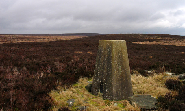
Trig point of Blackmoor Skirt
The name Blackmoor Skirt is printed in blue on OS maps at the 1:25 000 scale suggesting the name refers to a marsh or a water feature. The ground is certainly flat and presumably poorly drained.
 Map © Crown Copyright")
TIP: Click the map for more Large scale mapping
- Grid Square
- NY8289, 7 images (more nearby 🔍)
- Photographer
- Trevor Littlewood (more nearby)
- Date Taken
- Sunday, 25 February, 2007 (more nearby)
- Submitted
- Tuesday, 17 July, 2012
- Subject Location
-
OSGB36:
 NY 8251 8998 [10m precision]
WGS84: 55:12.2257N 2:16.5807W - Camera Location
-
OSGB36: NY 8250 8996
- View Direction
- Northeast (about 45 degrees)