2012
SK8171 : Fledborough Viaduct
taken 12 years ago, near to North Clifton, Nottinghamshire, England
This is 1 of 28 images, with title Fledborough Viaduct in this square
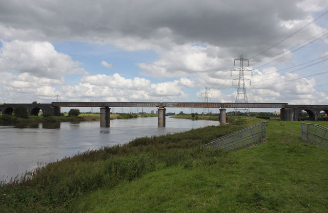
Fledborough Viaduct
The central girders across the river itself. They were a 1960s replacement for earlier bowstring trusses which were insufficient for heavy traffic.
River Trent
The River Trent is the third longest river in England (185 miles). It rises on Biddolph Moor, Staffordshire, then follows a generally north east to northerly path to join the River Ouse at Trent Falls. The Ouse & Trent combined form the Humber Estuary.
It is a very important river, economically having a number of Power Stations and industrial sites along its banks. It is navigable as far as Burton-On-Trent.
Wikipedia: Link
 Map © Crown Copyright")
TIP: Click the map for more Large scale mapping
- Grid Square
- SK8171, 242 images (more nearby 🔍)
- Photographer
- Alan Murray-Rust (more nearby)
- Date Taken
- Sunday, 15 July, 2012 (more nearby)
- Submitted
- Tuesday, 17 July, 2012
- Subject Location
-
OSGB36:
 SK 816 715 [100m precision]
WGS84: 53:14.0832N 0:46.7083W - Camera Location
-
OSGB36: SK 816 713
- View Direction
- NORTH (about 0 degrees)