2012
TQ3272 : Tulse Hill: former church
taken 12 years ago, near to West Norwood, Croydon, England
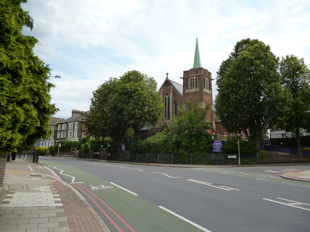
Tulse Hill: former church
This church seems to have both a tower and a spire, but it also appears to be used as Rosemead Preparatory School. The main road is Thurlow Park Road, part of the A205 South Circular road, and the road going up to the right is Elmcourt Road.
 Map © Crown Copyright")
TIP: Click the map for more Large scale mapping
- Grid Square
- TQ3272, 318 images (more nearby 🔍)
- Photographer
- Dr Neil Clifton (more nearby)
- Date Taken
- Saturday, 21 July, 2012 (more nearby)
- Submitted
- Sunday, 22 July, 2012
- Subject Location
-
OSGB36:
 TQ 3203 7285 [10m precision]
WGS84: 51:26.3560N 0:6.1075W - Camera Location
-
OSGB36: TQ 3200 7288
- View Direction
- Southeast (about 135 degrees)