2012
NY9707 : Blocked grip on Cleasby Hill
taken 12 years ago, 3 km from Whaw, North Yorkshire, England
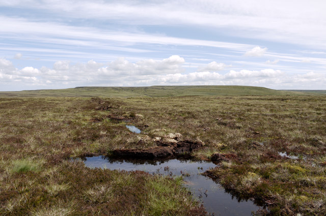
Blocked grip on Cleasby Hill
Cleasby Hill is a moorland rise on the north side of Arkengarthdale. The summit area is flat and its highest point almost impossible to discern though the OS record a spot height at 511m from which this image was recorded.
The image shows a fairly common feature to be seen on Pennine hill slopes these days.
Years ago farmers and other landowners were given grants to plough drainage channels across moorland in order to drain and so 'improve' the land. A change of policy has led to grants being made available to block those channels, known as grips, in order to re-water the moorland! One is seen here.
Hoove is the distant hill - a Marilyn.
 Map © Crown Copyright")
TIP: Click the map for more Large scale mapping
- Grid Square
- NY9707, 5 images (more nearby 🔍)
- Photographer
- Trevor Littlewood (more nearby)
- Date Taken
- Saturday, 21 July, 2012 (more nearby)
- Submitted
- Sunday, 22 July, 2012
- Subject Location
-
OSGB36:
 NY 979 078 [100m precision]
WGS84: 54:27.9449N 2:1.9697W - Camera Location
-
OSGB36: NY 979 078
- View Direction
- East-northeast (about 67 degrees)