2012
SK5638 : The western approach to Nottingham Station
taken 12 years ago, near to Nottingham, England
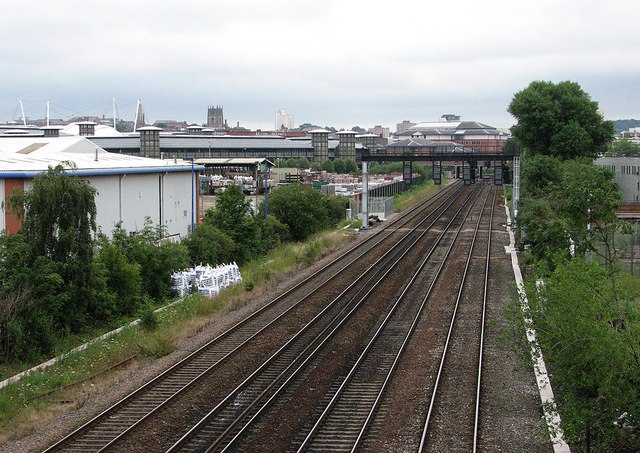
The western approach to Nottingham Station
In the days of steam, there were extensive goods yards to the left of the four-track main line occupying all of the land now given over to retail warehouses and the Inland Revenue buildings. The large Nottingham Midland engine shed (code 16A) was to the right - its site is now a retail park, Castle Park. For the view to the west from here, see SK5638 : Mansfield Junction.
 Map © Crown Copyright")
TIP: Click the map for more Large scale mapping
- Grid Square
- SK5638, 467 images (more nearby 🔍)
- Photographer
- John Sutton (more nearby)
- Date Taken
- Friday, 20 July, 2012 (more nearby)
- Submitted
- Monday, 23 July, 2012
- Subject Location
-
OSGB36:
 SK 5673 3895 [10m precision]
WGS84: 52:56.6969N 1:9.4328W - Camera Location
-
OSGB36: SK 5655 3887
- View Direction
- East-northeast (about 67 degrees)