2012
SJ9593 : Heritage Map
taken 12 years ago, near to Gee Cross, Tameside, England
This is 1 of 2 images, with title starting with Heritage in this square
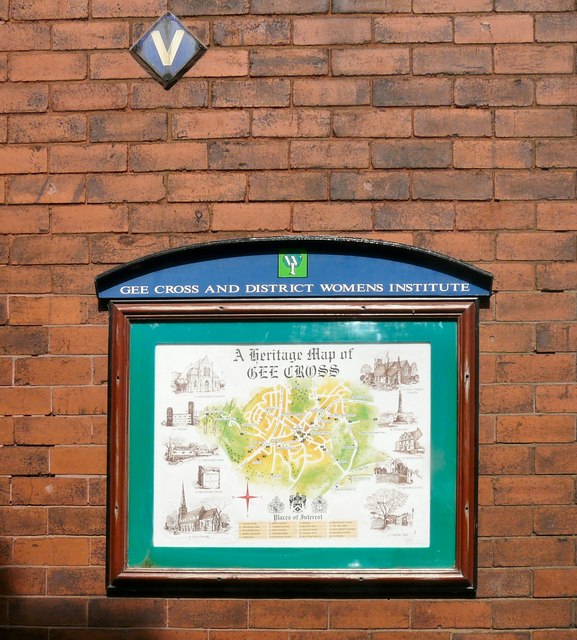
Heritage Map
A heritage map of Gee Cross drawn up by the local Women's Institute in 2000 hangs on the School Road side wall of the former Post Office.
 Map © Crown Copyright")
TIP: Click the map for more Large scale mapping
- Grid Square
- SJ9593, 983 images (more nearby 🔍)
- Photographer
- Gerald England (more nearby)
- Date Taken
- Sunday, 15 July, 2012 (more nearby)
- Submitted
- Thursday, 26 July, 2012
- Subject Location
-
OSGB36:
 SJ 9540 9340 [10m precision]
WGS84: 53:26.2414N 2:4.2426W - Camera Location
-
OSGB36: SJ 9539 9339
- View Direction
- Northeast (about 45 degrees)