2006
C1243 : Boyeeghter Strand and its neighbour from Rough Island
taken 18 years ago, near to Gortnalughoge, Co Donegal, Ireland
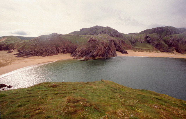
Boyeeghter Strand and its neighbour from Rough Island
Rough island is barely an island, only the highest tides separate it from the mainland. Having reached it it provides fine views back to the beaches, both of which are in the square, along with the peak behind it and Rough Island which the photographer is standing on.
Loading map... (JavaScript required)
- Grid Square
- C1243, 6 images (more nearby 🔍)
- Photographer
- Kieran Evans (more nearby)
- Date Taken
- Tuesday, 25 July, 2006 (more nearby)
- Submitted
- Saturday, 6 January, 2007
- Subject Location
-
Irish:
 C 12 43 [1000m precision]
WGS84: 55:14.3011N 7:48.2558W - View Direction
- South-southeast (about 157 degrees)