2012
TR3552 : Ordnance Survey bolt on Sholden Church
taken 12 years ago, near to Sholden, Kent, England
Ordnance Survey bolt on Sholden Church
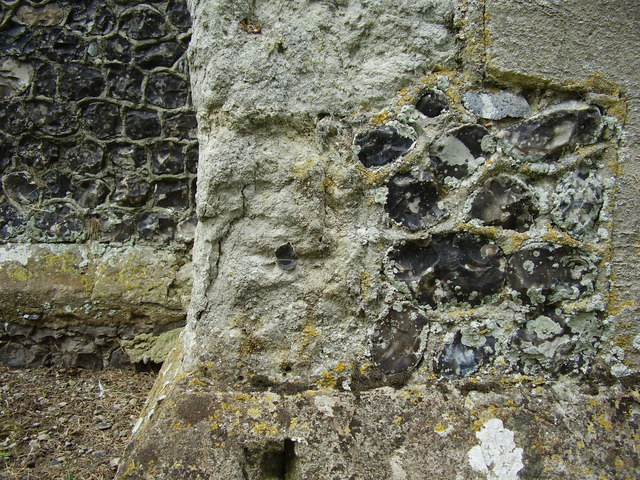
Ordnance Survey bolt benchmark on the north-west face of Sholden church tower. This bench mark was established in 1851 during the First primary levelling of England & Wales, and was levelled with a height of 56.2520 feet [17.1456 metres] above mean sea level (Liverpool datum). It was included on the London to Dover levelling line. The surveyor's description was "No. 360. Bolt in North-west face of Sholden Church tower, Upper Deal ; 1.31 ft.above surface (p197)." The chiselled OS broad arrow has completely eroded away, but the bolt with its horizontal datum line (centre of photo) has survived.
 Map © Crown Copyright")
TIP: Click the map for more Large scale mapping
- Grid Square
- TR3552, 82 images (more nearby 🔍)
- Photographer
- Shantavira (more nearby)
- Date Taken
- Wednesday, 8 August, 2012 (more nearby)
- Submitted
- Sunday, 12 August, 2012
- Subject Location
-
OSGB36:
 TR 3591 5216 [10m precision]
WGS84: 51:13.1918N 1:22.6156E - Camera Location
-
OSGB36: TR 3591 5216
- View Direction
- Northeast (about 45 degrees)