2012
SK1955 : Twodale
taken 12 years ago, near to Parwich, Derbyshire, England
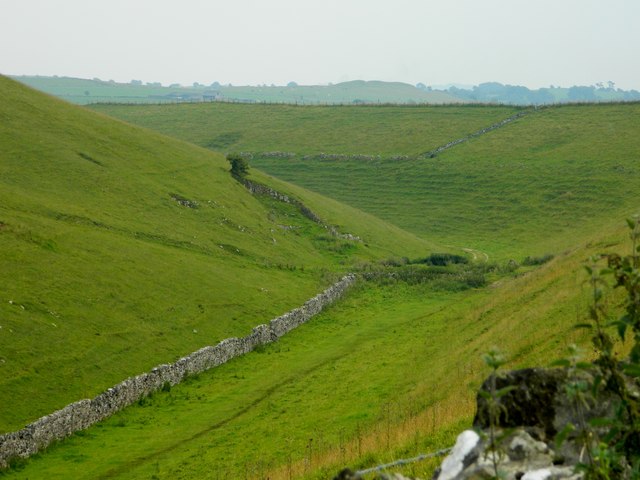
Twodale
Situated between two quarries, Hoe Grange Quarry (on the top of the hill on the left) and Ballidon Quarry (on the top of the hill on the right) and opposite Twodale Barn.
 Map © Crown Copyright")
TIP: Click the map for more Large scale mapping
- Grid Square
- SK1955, 16 images (more nearby 🔍)
- Photographer
- Rob Howl (more nearby)
- Date Taken
- Sunday, 12 August, 2012 (more nearby)
- Submitted
- Monday, 13 August, 2012
- Subject Location
-
OSGB36:
 SK 1955 5597 [10m precision]
WGS84: 53:6.0345N 1:42.5683W - Camera Location
-
OSGB36: SK 1943 5609
- View Direction
- Southeast (about 135 degrees)