2007
SS8832 : Dulverton: towards Higher Spire
taken 17 years ago, near to Liscombe, Somerset, England
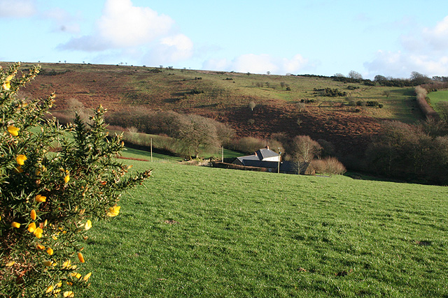
Dulverton: towards Higher Spire
Looking south east. The farmhouse sits near the top of a valley, its stream running roughly west to join the Barle at Tarr Steps
 Map © Crown Copyright")
TIP: Click the map for more Large scale mapping
- Grid Square
- SS8832, 15 images (more nearby 🔍)
- Photographer
- Martin Bodman (more nearby)
- Date Taken
- Wednesday, 10 January, 2007 (more nearby)
- Submitted
- Wednesday, 10 January, 2007
- Subject Location
-
OSGB36:
 SS 8817 3290 [10m precision]
WGS84: 51:5.0690N 3:35.8791W - View Direction
- Southeast (about 135 degrees)