2012
TQ1479 : The Hanwell Flight
taken 12 years ago, near to Norwood Green, Ealing, England
This is 1 of 4 images, with title The Hanwell Flight in this square
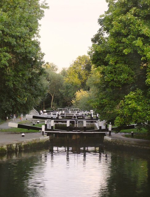
The Hanwell Flight
Looking 'downhill' from Lock 95, towards the two bottom-most locks of the flight, 96 and 97. In its day the flight (of six locks) must have been what we would now call a 'major infrastructure project'. It remains pretty impressive, to this day.
Shot taken on what was a very warm day in London - a peak of 30C was recorded in the late afternoon, and the temperature was still 27C at the time of this shot, at about 19.35.
Shot taken on what was a very warm day in London - a peak of 30C was recorded in the late afternoon, and the temperature was still 27C at the time of this shot, at about 19.35.
 Map © Crown Copyright")
TIP: Click the map for more Large scale mapping
- Grid Square
- TQ1479, 306 images (more nearby 🔍)
- Photographer
- Stefan Czapski (more nearby)
- Date Taken
- Sunday, 19 August, 2012 (more nearby)
- Submitted
- Monday, 20 August, 2012
- Subject Location
-
OSGB36:
 TQ 1497 7964 [10m precision]
WGS84: 51:30.2406N 0:20.6952W - Camera Location
-
OSGB36: TQ 1485 7974
- View Direction
- Southeast (about 135 degrees)