2012
NS2775 : Greenock and the Firth of Clyde
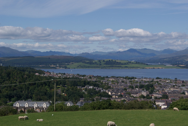
taken 12 years ago, near to Greenock, Inverclyde, Scotland
This is 1 of 4 images, with title Greenock and the Firth of Clyde in this square
Greenock and the Firth of Clyde
Viewed from Old Largs Road at the Old Waterhouse. The wooded area on the left is Greenock Cemetery.
Greenock Cemetery :: NS2676
The cemetery, which is laid out on Bow Hill, opened in 1846. For detailed information, see the Geograph article "Greenock Cemetery" Link and, for a map and useful guide, the booklet "Greenock Cemetery Walks" Link
(PDF) produced by East End Advisory (funded by Inverclyde Council); the PDF link works, as of January 2016.
 Map © Crown Copyright")
TIP: Click the map for more Large scale mapping
- Grid Square
- NS2775, 419 images (more nearby 🔍)
- Photographer
- Thomas Nugent (more nearby)
- Date Taken
- Wednesday, 8 August, 2012 (more nearby)
- Submitted
- Sunday, 26 August, 2012
- Subject Location
-
OSGB36:
 NS 2711 7512 [10m precision]
WGS84: 55:56.2769N 4:46.1739W - Camera Location
-
OSGB36: NS 2714 7501
- View Direction
- North-northwest (about 337 degrees)