2012
NR7241 : Forest break, Clachaig Water, Kintyre
taken 12 years ago, 3 km from Arnicle, Argyll And Bute, Scotland
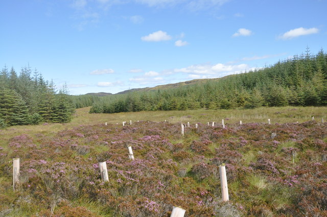
Forest break, Clachaig Water, Kintyre
An open area in the conifer forest where an attempt had been made to grow what, from the few surviving examples, might have been Rowan trees, in the centre of a patch of heather. It was in one of the few areas of dry ground.
 Map © Crown Copyright")
TIP: Click the map for more Large scale mapping
- Grid Square
- NR7241 (more nearby 🔍)
- Photographer
- David G Campbell (more nearby)
- Date Taken
- Thursday, 30 August, 2012 (more nearby)
- Submitted
- Thursday, 30 August, 2012
- Subject Location
-
OSGB36:
 NR 7211 4131 [10m precision]
WGS84: 55:36.7116N 5:37.2071W - Camera Location
-
OSGB36: NR 72040 41264
- View Direction
- East-northeast (about 67 degrees)