2012
SO1816 : A dry stone wall near Llangattock
taken 12 years ago, near to Ffawyddog, Powys, Wales
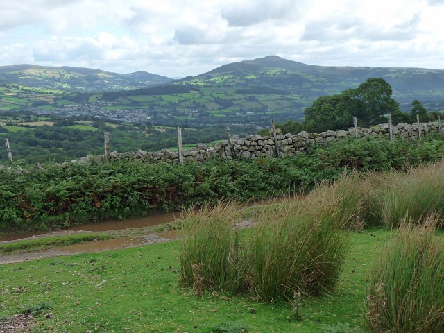
A dry stone wall near Llangattock.
This dry stone wall is the boundary between the open land of Mynydd Llangatwg and enclosed farmland.
The most prominent peak across the Usk Valley is Sugar Loaf (596m) in square SO2718.
The most prominent peak across the Usk Valley is Sugar Loaf (596m) in square SO2718.
 Map © Crown Copyright")
TIP: Click the map for more Large scale mapping
- Grid Square
- SO1816, 18 images (more nearby 🔍)
- Photographer
- Robin Drayton (more nearby)
- Date Taken
- Thursday, 30 August, 2012 (more nearby)
- Submitted
- Saturday, 1 September, 2012
- Subject Location
-
OSGB36:
 SO 1857 1682 [10m precision]
WGS84: 51:50.6412N 3:11.0063W - Camera Location
-
OSGB36: SO 1854 1681
- View Direction
- East-northeast (about 67 degrees)