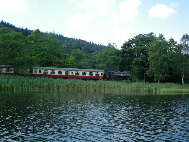
SD3786 : Train beside the River Leven
taken 21 years ago, near to Lakeside, Cumbria, England
The River Leven is an 8 mile long river that drains Windermere at its southern end. The river drains into Morecambe Bay.
Wikipedia: Link
Fell Foot Park is situated between the southern shore of Windermere and the A592. The park is owned and maintained by The National Trust.
More information at: Link
The Lakeside & Haverthwaite Railway runs from Haverthwaite at the southern end of the line via Newby Bridge to Lakeside at the southern end of Windermere. It is a former branch line of the Furness Railway and was opened on 1 June 1869.
The main revenue earner for the line then was freight, this being coal for the Windermere steamers, iron ore for the Backbarrow Iron Works, and sulphur and saltpetre for the Black Beck and Low Wood gunpowder works. The traffic in the opposite direction was mainly pig iron, gunpowder, pit props, ultramarine "blue" powder, wooden bobbins (from the Finsthwaite area) and livestock.
British Railways closed the line to passengers on 6 September 1965, and to all traffic two years later. In the late 1960s efforts by enthusiasts to reinstate the line were frustrated by both an unsympathetic British Railways and the local planning authority who wanted to turn the route into a footpath.
The line was eventually re-opened on 2nd May 1973, but no longer connects to the main-line railway system. At Lakeside, however it does still connect to the ferries on Windermere to Bowness and Ambleside.
Lakeside & Haverthwaite railway website: Link
 Map © Crown Copyright")
- Grid Square
- SD3786, 109 images (more nearby 🔍)
- Photographer
- DS Pugh (more nearby)
- Date Taken
- Sunday, 24 August, 2003 (more nearby)
- Submitted
- Sunday, 14 January, 2007
- Subject Location
-
OSGB36:
 SD 376 869 [100m precision]
WGS84: 54:16.4520N 2:57.5203W - Camera Location
-
OSGB36: SD 377 868
- View Direction
- West-northwest (about 292 degrees)