2012
HU2777 : The "sub" promontory
taken 12 years ago, near to Burnside, Mainland, Shetland Islands, Scotland
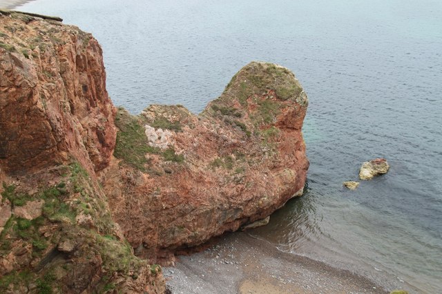
The "sub" promontory
A small promontory at the end of the greater one
 Map © Crown Copyright")
TIP: Click the map for more Large scale mapping
- Grid Square
- HU2777, 15 images (more nearby 🔍)
- Photographer
- Graeme Smith (more nearby)
- Date Taken
- Monday, 27 August, 2012 (more nearby)
- Submitted
- Thursday, 6 September, 2012
- Subject Location
-
OSGB36:
 HU 2741 7795 [10m precision]
WGS84: 60:29.0592N 1:30.1869W - Camera Location
-
OSGB36: HU 2740 7797
- View Direction
- Southeast (about 135 degrees)