2012
NS8492 : Track by River Forth
taken 12 years ago, near to Fallin, Stirling, Scotland
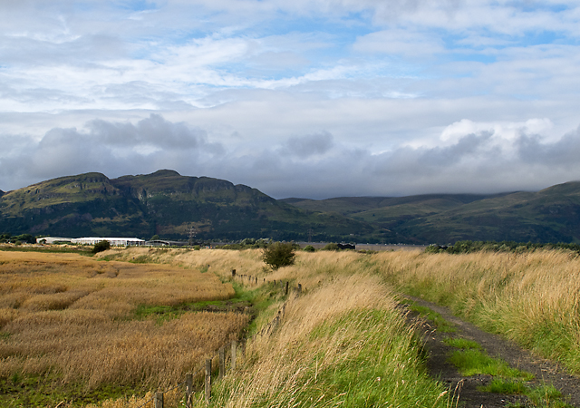
Track by River Forth
A track which follows the embankment on the River Forth near Haugh of Blackgrange, with Dumyat in the Ochil Hills visible in the distance.
 Map © Crown Copyright")
TIP: Click the map for more Large scale mapping
- Grid Square
- NS8492, 7 images (more nearby 🔍)
- Photographer
- William Starkey (more nearby)
- Date Taken
- Friday, 7 September, 2012 (more nearby)
- Submitted
- Friday, 7 September, 2012
- Subject Location
-
OSGB36:
 NS 8455 9287 [10m precision]
WGS84: 56:6.8747N 3:51.4958W - Camera Location
-
OSGB36: NS 8456 9284
- View Direction
- North-northwest (about 337 degrees)