2004
SS9103 : Farmland between Thorverton and Bowley
taken 20 years ago, near to Cadbury, Devon, England
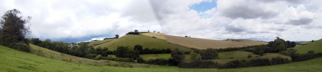
Farmland between Thorverton and Bowley
In the sheep grazing fields alongside the brook (River Jordan) which runs down through the centre of the village of Thorverton.
 Map © Crown Copyright")
TIP: Click the map for more Large scale mapping
- Grid Square
- SS9103, 37 images (more nearby 🔍)
- Photographer
- john spivey (more nearby)
- Date Taken
- Thursday, 10 June, 2004 (more nearby)
- Submitted
- Thursday, 28 July, 2005
- Subject Location
-
OSGB36:
 SS 91 03 [1000m precision]
WGS84: 50:49.2507N 3:32.5014W