2007
SX4554 : The Gap in the Wall
taken 17 years ago, near to Torpoint, Cornwall, Great Britain
The Gap in the Wall
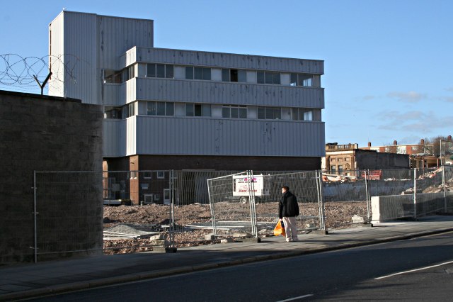
A few days before this photograph was taken, part of the high wall seen on the left of this photograph had been knocked down revealing what was behind. This is a significant event for Devonport as what lay behind the wall used to be the centre of the town until it was destroyed by bombing in World War Two then sequestered by the Admiralty to become part of the Naval Dockyard and filled with warehouses and other storage buildings. This cut the town in half and since then Devonport has been little more than a part of Plymouth's inner city. But now the warehouses are being demolished (the building in this photo is one of the few left) and after 60 years the old centre of Devonport is to be returned to the town with a mixture of houses and shops being built on this land.
 Map © Crown Copyright")
TIP: Click the map for more Large scale mapping
- Grid Square
- SX4554, 214 images (more nearby 🔍)
- Photographer
- Tony Atkin (more nearby)
- Date Taken
- Sunday, 14 January, 2007 (more nearby)
- Submitted
- Monday, 15 January, 2007
- Subject Location
-
OSGB36:
 SX 453 546 [100m precision]
WGS84: 50:22.2545N 4:10.6056W - View Direction
- West-northwest (about 292 degrees)