2012
SX7344 : Head of the Kingsbridge Estuary
taken 12 years ago, near to Kingsbridge, Devon, England
This is 1 of 2 images, with title Head of the Kingsbridge Estuary in this square
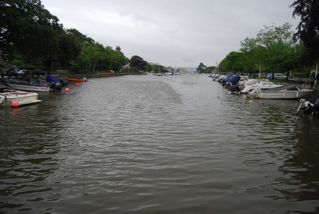
Head of the Kingsbridge Estuary
Kingsbridge Estuary (Salcombe Estuary) :: SX7343
The Kingsbridge Estuary is located in the South Hams area of Devon, running from Kingsbridge in the north to its mouth at the English Channel near Salcombe. The estuary is popular with sailors and holiday makers and it lies within the South Devon Area of Outstanding Natural Beauty (AONB).
The Kingsbridge Estuary is an extreme example of a ria as it has no main rivers running into it just a series of small streams.
Kingsbridge
Kingsbridge is a market town and popular tourist centre in the South Hams district of Devon, with a population of around 6000. It is situated at the northern end of the Kingsbridge Estuary, which is a superb example of a ria and extends six miles south of the town.
Wikipedia: Link
 Map © Crown Copyright")
TIP: Click the map for more Large scale mapping
- Grid Square
- SX7344, 340 images (more nearby 🔍)
- Photographer
- N Chadwick (more nearby)
- Date Taken
- Thursday, 7 June, 2012 (more nearby)
- Submitted
- Thursday, 13 September, 2012
- Subject Location
-
OSGB36:
 SX 7355 4400 [10m precision]
WGS84: 50:16.9429N 3:46.5705W - Camera Location
-
OSGB36: SX 7355 4401
- View Direction
- South-southeast (about 157 degrees)