2007
TL7804 : Buell Well - Danbury Common
taken 17 years ago, near to Danbury, Essex, England
Buell Well - Danbury Common
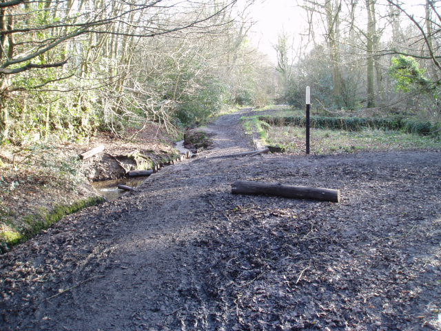
At the side of the footpath which runs along the eastern edge of Danbury Common is Buell Well. This provided the drinking water for Danbury in the 18th and early 19th Centuries.
On the right hand side of the photograph the foundations of the old pumping station are still visible.
On the left hand side of the photograph it is just possible to see the pipe from the well, from which spring water gushes all year round, even in drought conditions. (If you a fancy a drink on a hot summer's day, do not take water from the pool below the pipe as this is mixed with ditch water!)
 Map © Crown Copyright")
TIP: Click the map for more Large scale mapping
- Grid Square
- TL7804, 26 images (more nearby 🔍)
- Photographer
- Malcolm Reid (more nearby)
- Date Taken
- Monday, 15 January, 2007 (more nearby)
- Submitted
- Tuesday, 16 January, 2007
- Subject Location
-
OSGB36:
 TL 783 045 [100m precision]
WGS84: 51:42.6794N 0:34.8231E - Camera Location
-
OSGB36: TL 783 045
- View Direction
- SOUTH (about 180 degrees)