2012
TQ4628 : Track leading to Camp Hill Clump
taken 12 years ago, near to Fairwarp, East Sussex, England
This is 1 of 3 images, with title Track leading to Camp Hill Clump in this square
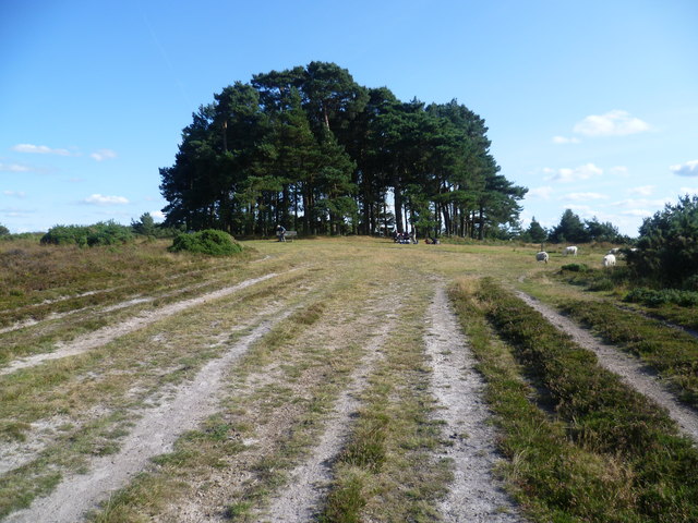
Track leading to Camp Hill Clump
Ashdown Forest is a former medieval hunting forest, and is the highest ridge of the High Weald. At ten square miles it is the largest open access area in the South East. Ashdown Forest was purchased by East Sussex County Council from the De La Warr family in 1988. It is now managed by a Board of Conservators. Nearly two thirds of it is heathland. One of the characteristics of the forest are these isolated clumps of trees. Camp Hill Clump was first planted in 1825. Its name probably derives from a military camp nearby. The Wealdway long distance path passes the clump. Some of the ubiquitous Ashdown Forest sheep can be seen to the right in the distance.
 Map © Crown Copyright")
TIP: Click the map for more Large scale mapping
- Grid Square
- TQ4628, 154 images (more nearby 🔍)
- Photographer
- Marathon (more nearby)
- Date Taken
- Saturday, 22 September, 2012 (more nearby)
- Submitted
- Sunday, 23 September, 2012
- Subject Location
-
OSGB36:
 TQ 4690 2897 [10m precision]
WGS84: 51:2.4787N 0:5.6412E - Camera Location
-
OSGB36: TQ 4680 2903
- View Direction
- East-southeast (about 112 degrees)