2012
SD9899 : Surrender Bridge
taken 12 years ago, near to Kearton, North Yorkshire, England
This is 1 of 15 images, with title Surrender Bridge in this square
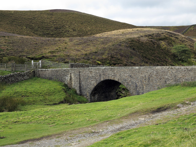
Surrender Bridge
The unusually named Surrender Bridge probably takes its title from the nearby Surrender Mill, a collection of ruined buildings in use in the long abandoned, local lead industry. It spans Mill Gill or Hard Level Beck.
 Map © Crown Copyright")
TIP: Click the map for more Large scale mapping
- Grid Square
- SD9899, 47 images (more nearby 🔍)
- Photographer
- Trevor Littlewood (more nearby)
- Date Taken
- Sunday, 23 September, 2012 (more nearby)
- Submitted
- Tuesday, 25 September, 2012
- Subject Location
-
OSGB36:
 SD 9885 9988 [10m precision]
WGS84: 54:23.6637N 2:1.1531W - Camera Location
-
OSGB36: SD 9891 9989
- View Direction
- WEST (about 270 degrees)