2005
SC3775 : Buck's Road, Douglas - Isle of Man
taken 19 years ago, near to Douglas, Isle of Man
This is 1 of 2 images, with title starting with Buck's Road in this square
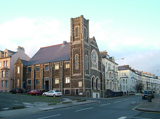
Buck's Road, Douglas - Isle of Man
This former church is now used as a storage building.
 Map © Crown Copyright")
TIP: Click the map for more Large scale mapping
- Grid Square
- SC3775, 377 images (more nearby 🔍)
- Photographer
- Jon Wornham (more nearby)
- Date Taken
- Monday, 10 January, 2005 (more nearby)
- Submitted
- Friday, 29 July, 2005
- Subject Location
-
OSGB36:
 SC 378 758 [100m precision]
WGS84: 54:9.1398N 4:29.1124W - View Direction
- North-northwest (about 337 degrees)