2012
NY4811 : West from Selside Pike
taken 12 years ago, near to Mardale Common [other Features], Cumbria, Great Britain
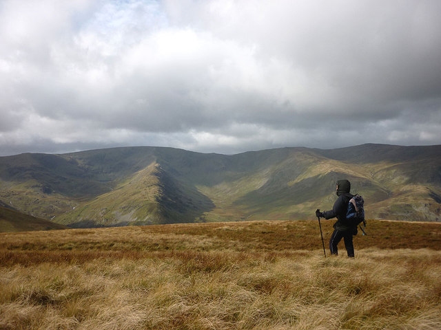
West from Selside Pike
A short distance west of the highest point and the convex slopes of the summit dome have receded enough to reveal the glaciated corries and tops of the High Street fells. From left to right: Mardale Ill Bell, High Street (with its Long Stile ridge seen end on), Kidsty Pike and High Raise.
 Map © Crown Copyright")
TIP: Click the map for more Large scale mapping
- Grid Square
- NY4811, 44 images (more nearby 🔍)
- Photographer
- Karl and Ali (more nearby)
- Date Taken
- Saturday, 29 September, 2012 (more nearby)
- Submitted
- Wednesday, 3 October, 2012
- Subject Location
-
OSGB36:
 NY 4896 1117 [10m precision]
WGS84: 54:29.5968N 2:47.3693W - Camera Location
-
OSGB36: NY 4896 1117
- View Direction
- WEST (about 270 degrees)