2012
SM7707 : Gateholm Island
taken 12 years ago, near to Marloes, Pembrokeshire/Sir Benfro, Wales
This is 1 of 11 images, with title Gateholm Island in this square
Gateholm Island
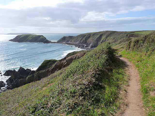
The Pembrokeshire Coast Path traverses the cliff top at the western end of Marloes Sands. Ahead is the tidal Gateholm Island. Skokholm Island SM7305 lies on the horizon.
 Map © Crown Copyright")
TIP: Click the map for more Large scale mapping
- Grid Square
- SM7707, 74 images (more nearby 🔍)
- Photographer
- Oliver Dixon (more nearby)
- Date Taken
- Friday, 14 September, 2012 (more nearby)
- Submitted
- Thursday, 4 October, 2012
- Subject Location
-
OSGB36:
 SM 7714 0732 [10m precision]
WGS84: 51:43.2123N 5:13.6754W - Camera Location
-
OSGB36: SM 77861 07728
- View Direction
- West-southwest (about 247 degrees)