2012
ST3036 : Pillbox on the west side of Westonzoyland Road railway bridge, Bridgwater
taken 12 years ago, near to Bridgwater, Somerset, England
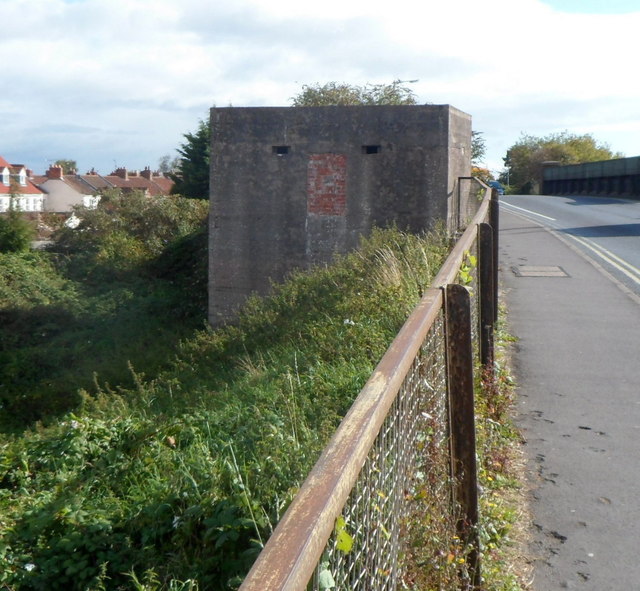
Pillbox on the west side of Westonzoyland Road railway bridge, Bridgwater
Located on the west side of Westonzoyland Road railway bridge. There is another pillbox on the east side of the bridge. Link
The pillboxes were part of The Taunton Stop Line, a World War II defensive line in SW England. It was designed to stop an enemy's advance from the west and in particular a rapid advance supported by armoured fighting vehicles (up to the size of a German medium tank) which may have broken through the forward defences.
After the war, farmers on whose land the pillboxes had been built, were paid £5 for each one they demolished. However, most of the very solid structures have survived, though many are in varying stages of decay after seven decades.
 Map © Crown Copyright")
TIP: Click the map for more Large scale mapping
- Grid Square
- ST3036, 220 images (more nearby 🔍)
- Photographer
- Jaggery (more nearby)
- Date Taken
- Thursday, 4 October, 2012 (more nearby)
- Submitted
- Saturday, 6 October, 2012
- Subject Location
-
OSGB36:
 ST 3078 3683 [10m precision]
WGS84: 51:7.5930N 2:59.4312W - Camera Location
-
OSGB36: ST 3077 3682
- View Direction
- East-northeast (about 67 degrees)