2007
SE8696 : Public Bridleway, Loose Howe Rigg
taken 17 years ago, near to Loose Howe Rigg [hill or Mountain], North Yorkshire, Great Britain
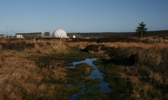
Public Bridleway, Loose Howe Rigg
Skirting RAF Fylingdales on the Public Bridleway which runs from Malo Cross to Lilla Cross. No doubt the ancient pannierman's road between these crosses took a more direct route. The current Public Bridleway looks as if it has been diverted to avoid MOD land.
 Map © Crown Copyright")
TIP: Click the map for more Large scale mapping
- Grid Square
- SE8696, 21 images (more nearby 🔍)
- Photographer
- Mick Garratt (more nearby)
- Date Taken
- Saturday, 20 January, 2007 (more nearby)
- Submitted
- Saturday, 20 January, 2007
- Subject Location
-
OSGB36:
 SE 868 961 [100m precision]
WGS84: 54:21.2044N 0:39.9126W - Camera Location
-
OSGB36: SE 868 961
- View Direction
- NORTH (about 0 degrees)